File:43-22424 map.JPG
Jump to navigation
Jump to search

No higher resolution available.
43-22424_map.JPG (626 × 375 pixels, file size: 39 KB, MIME type: image/jpeg)
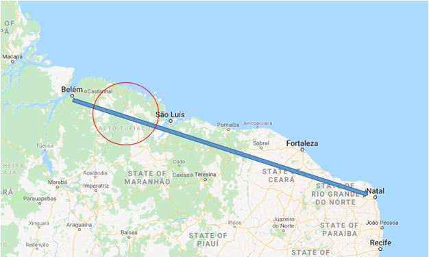
Map showing the final intended flight plan on 43-22424 and highlighting the area where the plane went missing. IHF
File history
Click on a date/time to view the file as it appeared at that time.
| Date/Time | Thumbnail | Dimensions | User | Comment | |
|---|---|---|---|---|---|
| current | 19:37, 8 December 2018 | | 626 × 375 (39 KB) | WikiSysop (talk | contribs) | Map showing the final intended flight plan on 43-22424 and highlighting the area where the plane went missing. IHF |
You cannot overwrite this file.
File usage
The following page uses this file: